Julkaistu

Orivirran saarto, GCJPM4

It’s interesting how the 35 kilometers of distance to the cache given by your GPS can change to 85 km just because of Finnish lakes. But this was the case when we visited Orivirran saarto. Since the cache description only has the background of the site in Finnish, we’ll give a short introduction to the site here.

Järvi-Suomessa GPS:ien ilmoittamat välimatkat ovat välillä varsin huvittavia. Meillä GPS ilmoittama matka kotoa kätkölle oli 35 km, mutta todellisuudessa auton mittariin kertyi 85 km ennen kuin olimme kätkön luona. Niin sitä vain kävi, että pari järven selkää piti kiertää matkalla Ylämyllyltä Savonrannalle.
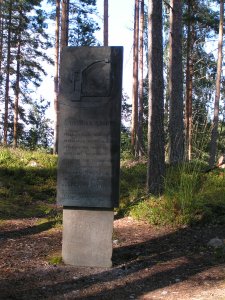
Orivirta monumentA view of the lake

The cache is located in the ruins (odd piles of rock) of an old Swedish fortress that was built sometime in the early half of the 16th century. At its peak it was manned by 300-400 men. It’s unknown when it was abandonded, but conversion work was done in the mid-17th century. The road to the cache is an old road to where the ferry across Orivirta used dock.

Itse kätkö sijaitsee vanhan ruotsalaisen linnakkeen raunioilla (röykkiö epämääräisiä kiviä). Linnake on rakennettu joskus 1500-luvun alulla ja huippuvuosinaan sen miehitys oli 300-400 miestä. Tarkkaa aikaa milloin linnake on hylätty ei tiedetä, mutta vielä 1600-luvun puolessa välissä siihen on tehty muutostöitä. Tie kätkön lähelle on vanha tie Orivirran ylittäneelle lossille.
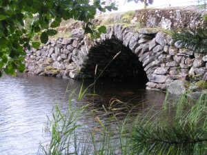
An old bridge

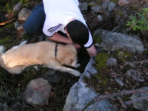
The road to the old ferry needed a bridge that has been preserved and is still in use. On the way to the cache we saw a rescue department boat heading for the docks. The boat ended up at a pier close to the cache, over the old bridge. This made us wonder, because often the crew of the boats take the fire engines to the pier with them and the old bridge didn’t have enough carrying capacity for such heavy equipment. However, our sighting was wrong and the boat wasn’t a rescue vessel, which solved that problem. The cache itself was hidden in the ruins (odd boulders lying about) of the fortress. This time it was Kassu who helped locate the cache.

Vanha lossin päätepistekin on saaressa, joten matkalla kylältä lossille on vanha silta, joka on onneksi jätetty paikoilleen ja on edelleen käytössä. Ajaessamme järven rantaa kohti kätköä, näimme pelastuslaitoksen veneen matkalla kohti laituria lähellä kätköä, vanhan sillan toisella puolen kylältä katsottuna. Tämä sai meidät ihmettelemään, sillä yleensä paloasemalta veneelle matkataan sammutusautolla eikä vanhan silta kestäisi sellaista painoa. Tilanne kuitenkin ratkesi kun näimme havaitsemamme veneen lähempää ja totesimme ettei kyseessä ollut pelastuslaitoksen venekalustoa. Itse kätkö löytyi linnoituksen raunioiden seasta Kassun avustaessa tällä kertaa.

Kassu and Ramin looking for the cache

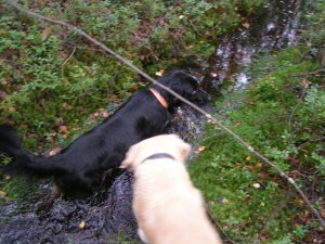
Once the cache was found we decided to amuse Flippe by throwing a stick all over the place. At times he didn’t see where the stick flew and had to look for it. One of those times gave us this shot of him, standing tall and proud.

Kun olimme kätkön löytäneet, päätimme huvittaa Flippeä heittelemällä keppiä joka puolelle rauniota ja vettä. Aina välillä silmät eivät pysyneet perässä ja Flippe joutui käyttämään nenäänsä etsinnässä. Yhdellä etsintäkerralla saimme tämän kuvan Flipestä seisomassa ylväänä.
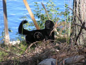
Flippe standing proud

Anna picking blueberriesWhile Flippe was chasing the stick, Anna started hunting for blueberries. While the blueberry season hasn’t been all that good (blame the weather), she found enough to sweeten our mouths. And no, the boys didn’t get any.

Anna picking blueberriesSillä välin kun Flippe jahtasi keppiä, Anna aloitti mustikoiden metsästämisen. Vaikka kesän sato ei olekaan ollut kovin kummoinen, saimme riittävästi makeutta suihimme. Ja pojat eivät saaneet yhtään mustikkaa.

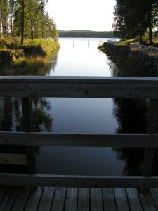
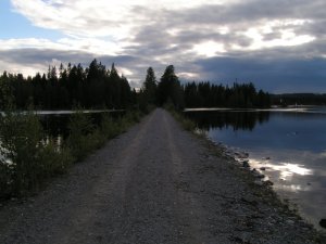
The modern bridge over Orivirta was built in 1965. It lets vessels with a maximum height of 12 meters to pass under it, so the bridge offers beatiful views of the surrounding lakeside to those driving over it. We just had to stop on the bridge to get a shot of the lake. Luckily there wasn’t any other traffic crossing the bridge at the time. The Finnish countryside is quite quiet on a Friday evening. On the way back, we had two tired retrievers sleeping peacufully in the back…

Orivirran ylittävä uusi silta on rakennettu vuonna 1965. Sen korkein alituskorkeus on 12 m, joten silta tarjoaa varsin muhkeat näkymät yli Orivirran ja lähisaarten. Onneksi sillalla ei ollut ruuhkaa ja saimme napattua muutaman kuvan (auto oli siis pysäytettynä sillalle). Suomen maaseutu on loppupelissä varsin hiljainen perjantai-iltana, jopa kesäisenä sellaisena. Paluumatkalla meillä oli jo kaksi väsynyttä noutajaa nukkumassa takapenkillä.
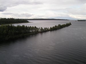
A view from the bridge Two tired retrievers

Cache visited 13.8.2004. View cache details.Kätköllä kävimme 13.8.2004.

Julkaistu

Kolvananuuro, GCJH3H

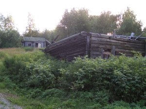
An abandoned farm

The Kolvananuuro cache is located just outside of the nature reserve. The nature reserve has been created to preserve a geological formation that is evidence of moving land masses and the latest ice age. Unfortunately we were running out of light so we didn’t have time to go wander around. More on Kolvananuuro sometime later when we have the time to go there.

Kätkö sijaitsee juuri Kolvananuuron luonnosuojelulalueen ulkopuolella. Luonnonsuojelualue on perustettu suojelemaan syvää rotkolaaksoa ja sen kasvustoa. Valitettavasti ilta alkoi jo hämärtyä emmekä ehtineet itse rotkolaaksoon. Mutta joskus myöhemmin selviämme sinnekin asti.

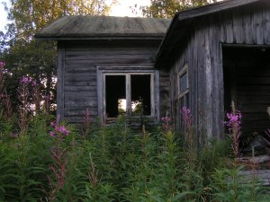
An abandoned farm

The cache itself is in an abandoned farmyard. The Finnish countryside, especially in North Karelia and other poorer areas, has many old farms that have been abandoned and left to ruin. We didn’t even see any evidence of fields near this old farm, so it must be decades since it has last been farmed. Our inquisitive natures lead us to explore inside the house. The old newspapers were dated to 1968. While it seems unlikely that the house would have been abandoned for almost 40 years, it certainly hasn’t been lived in for quite some time.

Itse kätkö on hylätyn maatilan pihapiirissä. Pihapiiri on hyvä esimerkki lukuisista pienistä ja köyhistä tiloista, jotka ovat jääneet hylätyiksi vuosien saatossa Suomen maaseudulla. Tilan lähettyvillä ei näkynyt jälkiäkään pelloista, joten siellä ei varmasti ole viljelty mitään vuosikymmeniin. Luonnollisesti kolusimme tilan rakennuksia muutenkin kuin kätkön löytääksemme. Talossa olevat sanomalehdet olivat vuodelta 1968. Tuntuu vain oudolta, että talo oli ollut hylättynä lähes 40 vuotta. Moneen vuoteen siinä ei kuitenkaan ole ollut asutusta.

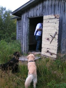
Ramin and Kassu investigating the farmhouseWhen we see, let alone visit, an abandoned house, we can’t help but wonder who was the last person to live here and what caused them to leave. Was it lovingly taken care of by an (older) couple until the realities of life and age forced them to move into town, or did it fall into disuse and ruin while the owner was somewhere drinking? Either way, it’s always sad to see an abandoned house – an enduring symbol of dead hopes and lost dreams…
Ramin and Kassu investigating the farmhouseAina kun näemme, saati sitten tutkimme, hylätyn talon jäämme miettimään talon viimeisiä asukkaita ja lähdön syytä. Huolehtiko talosta iäkäs pariskunta kunnes elämän ja iän tosiasiat pakottivat heidät muuttamaan kaupunkiin vai ajautuiko talo hunningolle omistajan ryypiskellessä ties missä? Oli syy mikä tahansa, on aina surullista nähdä hylätty talo – pysyvä merkki haudatuista toiveista ja kuolleista unelmista…

Just so we finish off without such heavy thoughts on our minds, nature again offered us a spectacular show of clouds and the setting sun.

Lopettaaksemme hieman mukavampiin tunnelmiin, kuva jälleen luonnon tarjoamasta kauneudesta auringonlaskun aikaan.

The evening clouds

We visited the cache on 12.8.2004. View cache details.Kätköllä kävimme 12.8.2004. Katso kätkön tiedot.

Julkaistu

Eno One, GCJG9D

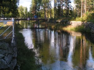
Canal viewEno One is near one of Eno’s canals. The river Pielisjoki was canaled in the latter half of the 19 century and three of the canals are located in Eno. While the dam of Kaltimo later made some of the canals unnecessary, their earthworks, and in some cases locks, still exist. We’ll start with a view of the end of the canal to the south (west ?).
Canal viewEno One (Enon ensimmäinen kätkö) sijaitsee yhden Enon monista kanavista rannalla. Pielisjoki kanavoitiin 1800-luvun jälkimmäisellä puoliskolla ja kolme jokeen rakennetuista kanavista on Enon kunnan alueella. Myöhemmin rakennettu Kaltimon voimalaitos on tosin tehnyt osan kanavista tarpeettomiksi, mutta niiden maavallit ja jotkut suluistakin ovat vielä jäljellä. Aloitamme näkymällä sululta etelään (länteen ?).

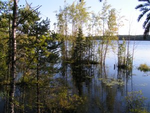
The right side of the picture is a land barrier between the canal part of the river and the naturally flowing one. The water levels around the Kaltimo canal have risen somewhat after the dam was built, creating interesting little islands.

Kuvan oikeassa reunassa on maavallia kanavan ja itse joen välillä. Kaltimon kanavan ympäristön vedenkorkeus on noussut selkeästi voimalaitoksen rakentamisen jälkeen joten maasto on muuttunut alkuperäisestä. Tämän seurauksena on myös syntynyt joitakin hauskoja pieniä saaria.

Canal islands

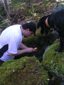
Ramin and Flippe searchingFlippe proved to be a great help in looking for the caches. Or at least he kept thinking that he’d be a great help. Ramin took care of the looking for the cache, leaving Anna to concentrate on what she’d write in the log :).
Ramin and Flippe searchingFlippe osoittautui mainioksi avuksi kätköjen etsinnässä – tai niin hän ainakin luuli. Ramin hoiti tässä tapauksessa kätkön etsimisen Annan keskittyessä siihen, mitä logiin kirjoittaisi :).

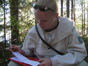
Anna entering our log

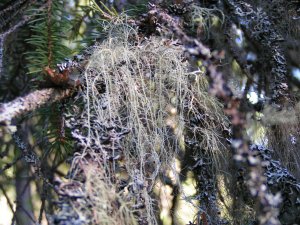
Even though there is a large paper and pulp mill 20 kilometers or so to the northeast of Eno, the air here is quite clean. A good indicator of the air quality here is the moss shown in the picture below. It only grows in areas where the air is good. In fact, in many Finnish cities and towns this moss has gained more ground in the last decade as the amount of pollution emitted by industry and vehicles has been reduced.

Vaikka Enosta ei olekaan pitkä matka Uimaharjun tehtaalle, näkyy ilmansaasteiden väheneminen selvästi kun puista löytyy runsaasti jäkäläkasvustoja. Muistan (Ramin) itsekin ajan, kun Lappeenrannassa ei puista tahtonut jäkäliä löytyä sekä kun niitä alkoi taas esiintyä ilmansaasteiden vähennyttyä.

Lichen Canal view

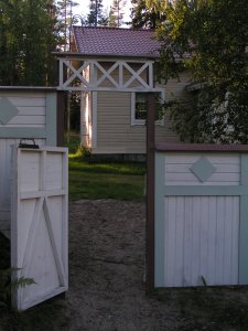
Lockkeeper’s houseIt’s odd how even though Anna has rowed through the canal twice and Ramin has driven around in that area quite a bit, neither one of us remembered the southernmost lock of the Kaltimo canal. Next to the site of the lock is an old building that the county of Eno uses and rents for various occasions.
Lockkeeper’s house Vaikka Ramin on ajanut Enossa melko paljon ja Anna on kahdesti soutanut Kaltimon kanavan läpi, ei kummallakaan meistä ollut muistikuvia eteläisimmästä sulusta. Tämän viimeisen sulun vierellä on entinen sulunvartijan talo, jota Enon kunta käyttää ja vuokraa erilaisiin tilaisuuksiin.

Today the land barrier between the canal and the river is a walkpath and accessway to the lockkeepers house. Again, the higher water levels (especially now after all of our rains) are clearly visible by how low the causeway is. In fact, at one point there was about 20 cm of water on it. Walking along it Flippe got his first taste of what a real current in the water does. The sticks he had to fetch moved in novel ways…

Nykyisin kanavan ja joen välinen maapenger on kävelyreitti ja huoltotie sulunvartijan talolle. Tässäkin padon aiheuttama vedennousu näkyy selvästi (etenkin näin sateisena kesänä) kun huoltotie on nipinnapin veden pinnan yläpuolella – ja paikoin sen allakin. Joen vartta kulkiessamme Flippe sai ensituntumaa kunnon virtauksen vaikutukseen vedessä. Veteen heitetyt kepit eivät käyttäytyneetkään ihan totutulla tavalla…

Causeway

We visited the cache on 12.8.2004. View cache details.Kätköllä kävimme 12.8.2004. Katso kätkön tiedot.

Julkaistu

Swamp1, GC320A

Swamp1 is located in the northeastern parts of Joensuu, quite close to habitation. It’s a nice and easy one to look find as a first cache. It’s located in a fairly typical dried swamp. The idea with a dried swamp is that ditches are dug in the swamp to let the water of the swamp seep out while still leaving the ground moist and fertile and thus a great location to grow trees in. And Finland is the promised land of forestry.

Kätkö on Joensuun koillisosissa varsin lähellä asutusta. Eli helppo kätkö ensimmäiseksi kätköksi (tosin sittemminhän noita kätköjä on tullut lähemmäksikin kaupunkia ja asutusta). Kätkön alue on varsin tyypillisestä ojitettua suota ja metsää, joten ojien ylityksiin on syytä varautua.

Blueberries

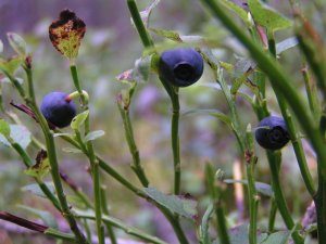
While this summer isn’t going to be all that good when it comes to blueberries (it’s been too cold), the route we took had quite a few. At least enough to keep us stopping and eating them every now and then. The afore mentioned ditches were mostly small and narrow so that we could easily jump over them. However, no ditch is ever too small for Flippe to go for a swim.

Vaikka kuluva kesä ei olekaan mustikoiden kannalta mitenkään hyvä, valitsemamme reitin varrella oli useampia mustikoita matkaevääksi. Suurin osa jo mainituista ojista oli varsin pieniä ja kapeita, joten niiden yli oli helppo hyppiä. Mikään oja ei kuitenkaan ole liian pieni Flipelle uintipaikaksi.

Flippe in a ditch

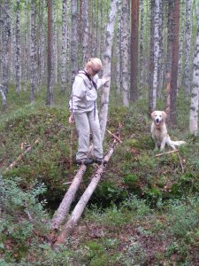
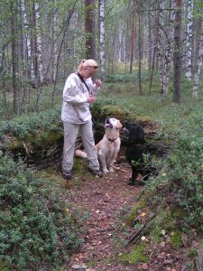
But not all of the ditches were small. This one was wide enough that jumping over it didn’t seem like a good idea. Luckily someone had been chopping down some small trees along the ditches bank that we used to build a bridge. Finally after some wandering (and coaxing to get Kassu across the ditch), we found the cache.

Valitettavasti kaikki ojat eivät olleet pieniä. Tässä esimerkiksi yksi sellainen, jonka yli hyppääminen ei tuntunut järin järkevältä ratkaisulta. Onneksi joku oli harventanut ojien reunalla puustoa, joten saimme kevyen sillan rakennettua. Lopulta hetken vaeltamisen (ja Kassun ojan ylitykseen houkuttelun) jälkeen löysimme kätkön.

Kassu and Anna crossing a ditch Anna, Kassu and Flippe near the cache

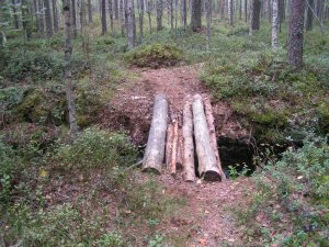
On the way back we found a better route back that didn’t include quite that many ditches. And a much better bridge than the one we made…

Paluumatkalla löysimme reitin, jonka varrella ei ollut aivan niin montaa ojaa. Ja huomattavasti parempi silta, kuin meidän aiemmin tekemämme…

A log bridge crossing a ditch

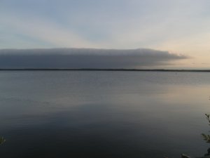
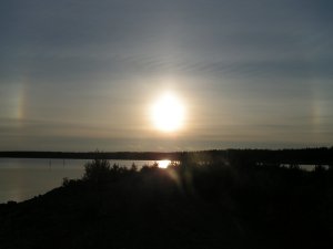
While driving home, nature offered us with some nice clouds over the lake (Pyhäselkä) and the odd light effects around the sun. All in all, it was a very enjoyable couple of hours spent in the forest and wandering near recent urban developments looking at all of the new homes being built.

Paluumatkalla luonto tarjosi meille kauniita pilviä Pyhäselän yllä ja haloja auringon ympärillä. Kaiken kaikkiaan vietimme erittäin mukavan parituntisen metsässä ja uusien asuntoalueiden laidoilla katsellen vasta rakennettuja taloja.

Stormclouds over the lake The sun and halos

Cache visited 9.8.2004. View cache details.Kätköllä kävimme 9.8.2004. Katso kätkön tiedot.